
Over the last few months there has been a rash of deadly accidents around construction sites in Ulaanbaatar. Two accidents in particular, one involving a little girl crushed by a crane and another involving a college student hit by falling debris, have galvanized public opinion against the rapid and unregulated development that has been occurring in the city over the last decade.
For several weeks many of the lead stories and opinion pieces in the three newspapers I regularly read (Өнөөдөр, Зууны мэдээ, and Улс Төрийн Тойм) conveyed public outrage over the accidents and documented a growing list of names being named of people associated with projects that were under construction in the city without permission or violating any number of municipal statutes.
It is hard to write about Ulaanbaatar’s development without a sense that you are chronicling a colossal failure of city planning (or lack thereof), and many of the articles and opinion pieces used the set up that Ulaanbaatar has gone from unlivable to downright deadly to tell their stories. The irony is that it’s not really a problem of regulation but rather of enforcement. Ulaanbaatar does have an official city plan, and there is no lack of laws regarding the construction of buildings. There is just minimal or sporadic enforcement. The I-don’t-know-whether-to-laugh-or-cry bit of information to emerge from all the stories was that of the 80 construction projects underway in Ulaanbaatar deemed to be operating without legal authorization 10 were government funded.
These construction site accidents have given city dwellers an opportunity to express in a unified voice their frustrations about what is happening to the city. This made me wonder if there was a way to visually demonstrate the changes that have occurred in the city over the last few years. Google Earth provides a nice feature that allows you to look at historical satellite images of places on the Earth. I decided to use this feature to look at changes in a Ulaanbaatar neighborhood.
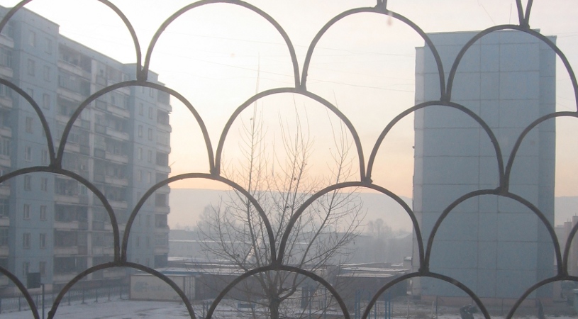
The neighborhood I chose was the northern half of the 13th District which is home to the Wrestling Palace. I’d like to say there is some scientific reason I chose this neighborhood, but there isn’t. It just happens to be a neighborhood I lived in 2006-2007. I was in Building No. 5, which is directly south of the three brick apartment towers on Peace Avenue. My apartment had a nice southernly view of an open field and the mountains when I moved in. It had a view of another apartment in another building and not a single window receiving direct sunlight when I moved out in 2007.

The graphical overlay above is derived from a satellite image of the neighborhood in March 2005. The green circle is the Wrestling Palace and the purple block is Building No. 5. There are approximately 155 structures marked in the image. Below is the same neighborhood in March 2011 with new buildings marked in red. There are approximately 80 new buildings in the image.1 If you do the math, that means just over 13 new buildings a year from 2005 to 2011. Note that the area represented in the images is just over a square kilometer.

The satellite image below is the most current image of the neighborhood in Google Maps. It gives another sense of just how crowded the block has become.
Although I didn’t choose this neighborhood because it was scientifically assessed to be “representative,” I think it does provide a reasonable demonstration of the changes that are occurring in the city and their rapid pace. It should be noted, however, that the choice of the neighborhood is a reflection of my own socio-economic circumstances, and I don’t want to give the impression this is the worst of it. Anyone living in one of the outlying ger districts could tell a more depressing story. Residents in those districts get the worst of all possible worlds: the lack of services, poor housing options, and sense of remoteness of the countryside along with the crime, pollution, and noise of city living. A ger district would represent the worst case in my opinion.
In spite of Ulaanbaatar’s increasingly unlivable conditions, it continues to grow year after year as people seek economic opportunities in the city. It also has the unique quality of offering escapes from the harshness of life in the rest of the country. As an example of what I mean, I found when leading academic tours in the past that new visitors to Mongolia were often not impressed by Ulaanbaatar at first. In fact, they often started off bordering on contempt leaning towards hatred. It is after all a fairly ugly and dirty city with few (and ever fewer) iconic tourist sites. Don’t get me wrong. I think Ulaanbaatar has its charms, but more like Mr. Rochester in Jane Eyre than Mr. Bingley in Pride and Prejudice.2 They’re charms you grow to love rather than loving right off the bat. And this held true with visitors I led. Their low opinions often adjusted upwards after experiencing a week or two of deprivation in the countryside without running water, electricity, heating, restaurants, or other amenities of modern living. So, in other words, as long as it remains difficult to find a good Indian buffet in the rest of the country, Ulaanbaatar will continue to be the place to be in spite of its numerous shortcomings. I can only hope, though, that the recent public outrage turns into a sustained discussion that ultimately leads to making Ulaanbaatar truly a livable city–not just relative to a lonely ger on the windswept steppe. At this point it has a long way to go.
Footnotes
1. This count is approximate and is intended to give more a sense of magnitude rather than precious. A more skilled analyst of satellite photos would undoubtedly arrive at a different number, but I hope it would be close to my count.
2. Mr. Rochester is brooding, disagreeable, and not particularly handsome and Mr. Bingley is affable, amiable, and handsome. Jane Eyre comes to love Mr. Rochester over time, where as Jane Bennett loves Mr. Bingley almost from the start.